This is the big mountain on the south side of town with all of the antennae sticking out of it.
Directions from downtown...
Take 550/160 south to County Road 210. Turn right at the stop light. Go a couple hundred yards and turn right. Parking is on the left. There is no sign at trailhead.
This is a really cool trail. It is only about a mile long, but it climbs about 1200 feet. The trail heads down a steep little hill and crosses a stream before it really gets going. The first bit is the hardest. It climbs a few hundred yards then goes nearly vertical. Eventually, it levels off... but not for long. The rest of the trail is a steep uphill climb with very few cutbacks and lots of loose dirt and baseball size rocks. At the top, the trail enters a nice grassy meadow. I have heard that this used to be the launch area for local paraglider pilots. If this is true, they have more testicular fortitude that me. The meadow, backs up to the edge of a cliff that is nearly 1200 feet from top to bottom. The mountain is still open to paragliders, but the action slowed tremendously when a gate was erected on the road that accesses the antennae on the summit. The view from the top is amazing. The picture above was taken from the top of Smelter Mountain.
Durango, CO
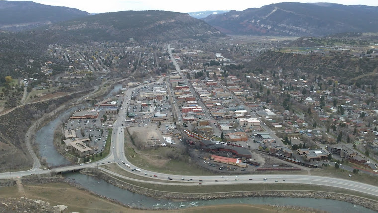
view looking north from Smelter mountain
No comments:
Post a Comment